UN
6 Merchants Way
£ 145,000
Description
We don't have a Description for this property.
- Bedrooms
- 4
- Bathrooms
- 0
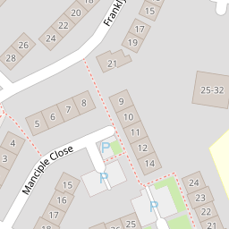

Leaflet © OpenStreetMap contributors
The heatmap indicates the level of crime in the area. The color of the heatmap indicates the crime severity and recency.
Metrics Year-on-Year
- Average area value
- 258,798.00 £Decreased by 0.12 %
- Average area rental value
- 1,121.00 £/moDecreased by 6.97 %
- Est rental Yield
- 5.20 %Decreased by 6.81 %
- Crime Rate
- 25.00 %Unchanged by 0.00 %
from 259,119.00 £
from 1,205.00 £/mo
from 5.58 %
from 25.00 %
Nearby Schools
| Name | Type | Ofsted | Distance |
|---|---|---|---|
| The Canterbury Primary School | Academy Converter | Good | 0.39 KM |
| The Canterbury Academy | Academy Converter | Good | 0.74 KM |
| Kent College Nursery, Infant And Junior School | Other Independent School | 1.41 KM | |
| St Edmund'S School Canterbury | Other Independent School | 1.58 KM | |
| Little Hands Children'S Centre | Children's Centre | 1.67 KM |
Images
Nearby Streets
| Name | Average Price | Average Sqft | Distance |
|---|---|---|---|
| Bishops Way | £ 0 | 0 | 0.00 KM |
| Stranger's Close | £ 230,000 | 0 | 0.00 KM |
| The Close | £ 514,333 | 0 | 0.00 KM |
| Cow Lane | £ 0 | 0 | 0.00 KM |
| Warren Lodge | £ 446,333 | 0 | 0.00 KM |
Nearby Transport
| Name | NLC | TLC | Distance |
|---|---|---|---|
| Canterbury East | 5164 | CBE | 2.19 KM |
| Canterbury West | 5007 | CBW | 2.20 KM |
| Chartham | 5008 | CRT | 4.83 KM |
| Sturry | 5029 | STU | 7.72 KM |
| Bekesbourne | 5198 | BKS | 9.06 KM |
Nearby Listings
| Address | Price | Type | Score | Distance |
|---|---|---|---|---|
| Merchants Way, Canterbury, CT2 | £ 325,000 | BUY | 5 / 10 | 0.01 KM |
| Priest Avenue, Canterbury, Kent, CT2 | £ 300,000 | BUY | 7 / 10 | 0.12 KM |
| Priest Avenue, Canterbury, Kent, CT2 | £ 290,000 | BUY | Unknown | 0.12 KM |
| Priest Avenue, Canterbury, Kent, CT2 | £ 275,000 | BUY | 6 / 10 | 0.14 KM |
| Wife Of Bath Hill, Canterbury | £ 280,000 | BUY | 6 / 10 | 0.21 KM |
Nearby Properties
| Address | Price | Distance |
|---|---|---|
| 46 Merchants Way | £ 163,000 | 0.00 KM |
| 44 Merchants Way | £ 250,000 | 0.00 KM |
| 36 Merchants Way | £ 165,000 | 0.00 KM |
| 27 Merchants Way | £ 138,000 | 0.00 KM |
| 10 Merchants Way | £ 185,000 | 0.00 KM |